
Natural Forestry
Monitoring Platform
Natural forest monitoring begins with better visibility.
Natural Forestry
Monitoring Platform
Natural forest monitoring begins with better visibility.

Natural Forestry Monitoring
Natural Forestry Monitoring
“Gain real-time visibility into deforestation, illegal logging, biodiversity loss, and environmental degradation without relying on delayed field surveys or fragmented reporting.”
SWIFTForest transforms high-definition satellite imagery into actionable environmental intelligence, enabling organisations to monitor forest loss, detect illegal harvesting, map carbon-rich ecosystems, and track landscape health through a single integrated platform.
We’re proud to work with



Extensive experience in woodland ecosystems
Our deep-rooted experience in natural forest management allows us to deliver precise, high-value analytics that reflect the complex realities of diverse woodland ecosystems.

We monitor over
100+ Million Hectares
Of forestry land worldwide
The system makes use of 3rd party forestry disturbance alerts and optical satellite imagery for verification. All analyses are updated on a weekly basis.
All the information gathered through the imagery is stored and used to highlight potential trends and risk.
Who is SWIFTForest built for?
If forestry decisions matter to your role, SWIFTForest fits your workflow.
SWIFTForest supports the full forestry chain, from strategic oversight to boots-on-the-ground operations. Whether you’re shaping long-term plantation strategy, managing daily operations, or tracking conditions in the field, the platform delivers clear, shared visibility across teams.

Government
SWIFTForest supports government owned forests by managing encroachment, providing trend insights and ensuring compliance with environmental laws.
NGO’s/NPO’s
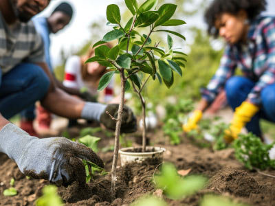
NGOs/ NPOs benefit from the remote nature of SWIFTForest’s platform allowing them to monitoring forests all over the world.
Commercial Forestry
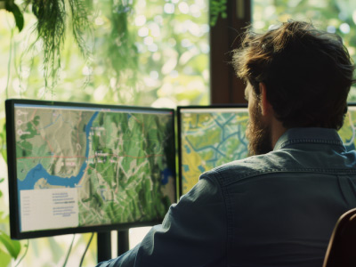
Commercial foresters benefit from SWIFTForest through its health and harvest tracking, optimising production and yield.
Natural Forestry
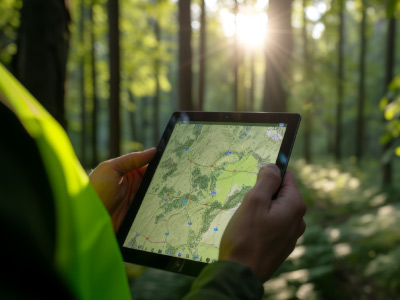
Natural foresters use SWIFTForest to maintain forest health while monitoring for any illegal deforestation.
Platform functionality
After years of experience in the forestry industry, we saw the same challenges repeated across teams of all sizes: paper-led visibility, rising risks, costly field visits, and slow, paper-based reporting.
We started this platform to close that gap, to give forestry managers a simple, reliable way to monitor their assets, catch problems early, and make smarter decisions with less effort.
01
Register on SWIFTForest & Upload areas of interest (AOIs)
02
Determine desired monitoring frequency
03
3rd party disturbance alerts fused with either Sentinel-2 or PlanetScope satellite imagery
04
The system runs analysis weekly on predefined areas of interest, providing the end-user with near-real-time deforestation disturbances, forest degradation and areas of concern.
05
Dashboard will auto-update with the latest imagery and analytics
06
Platform is secure and ready-to-use
SWIFTForest
Platform
Core Capabilites
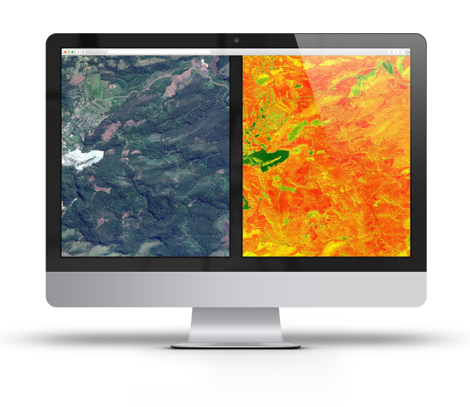
SWIFTForest combines third-party disturbance alerts with in-house verification and tailored spatial analysis to deliver accurate, actionable forestry intelligence. Through customised heatmap analysis, the platform identifies areas of elevated concern and provides clients with clear visual risk assessments to support informed decision-making and prioritised monitoring efforts.
SWIFTForest also offers EUDR risk assessment, verification, and reporting services, helping clients better understand deforestation-related risks, strengthen supply chain transparency, and support compliance with the European Union Deforestation Regulation (EUDR).
Valuable insights
Using 3rd party disturbance alerts combined with in-house verification and analysis, tailored to your requirements, provides valuable insights and decision support.
Heatmap analysis
Heatmap analysis to provide insights and areas of great concern. Tailored to your specific areas to produce an overall risk assessment.
EUDR Risk assesment
EUDR risk assessment, verification, and reporting. Providing clients with insights into your EUDR risk.
We understand that forestry is complex. In addition to our SWIFTForest Monitoring solution, we also offer a range of add-on services.
Add-ons include:
- In-field Surveys
- Tree Count & Height
- Volume Calculations
- Above Ground Biomass
- Biodiversity Assessments
- Digitisation
- High Resolution Base Mapping
- Post-Fire & Burn Scar Analyses
- Ultra high resolution satellite imagery tasking
User Experience
We have designed our SWIFTForest platform to be as intuitive and easy-to-use as possible, so that all partners in the forestry industry can access the knowledge and insights the platforms provide.
Our SWIFTForest platform is live & interactive.

Our systems are REST
API compatible and can
be linked or integrated
into existing systems if
necessary.
Simple login
Intuitive colours
Legends & Labelling
Fast load times


Platform display

Homepage – Map page
The homepage of the platform, the Map page, is the best page for viewing RGB and Alert visualisation
The Map page has additional features such as time sliders, filters, and dual map modes which are useful for visualising and comparing areas or zones.
Homepage – Mapping
Layers can be toggled on or off, including:
- RGB Imagery
- Disturbance alerts
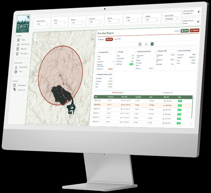
- Wildfire tracking
These separate layers help to visuals all the areas/zones and their unique health and harvesting information.

Monitoring Page
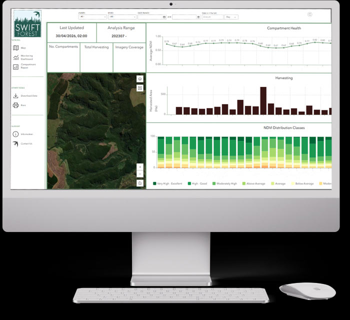
The Monitoring page is designed to integrate imagery with analytical insights. Users can select individual, grouped, or all areas to monitor natural forest conditions, including degradation, deforestation, and disturbance alerts through the latest spatial data and change detection analysis.
Report Page
Print out a report using the report tool, which gives a detailed display of all health, stress & harvesting data available.
This can be a specific or a general report depending on the user’s selection at time of printing. The report layout is customisable.
Pricing
Our costing is compromised of the following
Platform
cost
Storage
and Hosting Fee’s
Setup Fee
*New client only
Support hours
*support hours are optional but recommended
Our solutions are tailored-made & no two forests are the same. As such, pricing is not fixed & quotations are free-of-charge & remain valid for 30 days.
Platform costs are charged at a fixed rate per hectare.
Frequently Asked Questions
SWIFTForest is designed for government departments, NGOs, NPOs, conservation organisations, landowners, sustainability teams and businesses responsible for natural forest areas. It can support biodiversity protection, conservation planning, EUDR risk assessment, carbon reporting, environmental compliance, wildfire analysis and long-term forest management.
SWIFTForest can help identify and monitor deforestation, forest degradation, canopy loss, wildfire damage, burn scars, encroachment and other forms of landscape disturbance. GIS analysis helps place each detected change within its wider environmental and geographical context. Potential disturbances can then be verified using recent satellite imagery or targeted field inspections.
Satellite imagery allows organisations to observe natural forests without relying only on physical inspections. SWIFTForest can use frequent PlanetScope imagery to monitor broad landscape change and higher-resolution Planet SkySat or Vantor imagery to examine specific disturbances in greater detail. Swift Geospatial’s GIS specialists select imagery according to the monitoring area, required detail, frequency and project objectives.
SWIFTForest supports natural forest monitoring by combining recurring satellite imagery with disturbance alerts and GIS expertise. The platform monitors predefined areas of interest and provides updated maps, analytical layers, heatmaps and reports. This helps conservation teams understand what changed, where it happened and which areas may require investigation or intervention.
Forest conservation technology includes satellite imagery, GIS analysis, remote sensing, disturbance alerts and digital reporting tools used to protect natural forests. SWIFTForest brings these technologies together within an interactive platform, helping organisations detect deforestation, degradation, wildfire damage, encroachment and other environmental changes across large forest landscapes.
Near real-time monitoring has become essential in modern forestry because environmental threats rarely wait for scheduled inspections. Wildfires spread fast, illegal logging can happen overnight, and encroachment often begins quietly before expanding into a much larger problem. The faster these changes are identified, the faster organisations can respond.
This is where SWIFTForest and Swift Geospatial’s global monitoring experience become especially valuable. As a premier GIS and earth observation monitoring company, Swift Geospatial has worked across diverse environments and industries worldwide, developing monitoring systems designed to operate at scale across complex and often remote landscapes. That experience has shaped SWIFTForest into a platform focused not just on collecting imagery, but on delivering actionable environmental intelligence quickly and reliably.
Using recurring satellite imagery, GIS analytics, and automated change detection workflows, SWIFTForest enables organisations to monitor forests in near real time. This allows forestry managers, conservation teams, and environmental stakeholders to detect wildfires, illegal logging, canopy decline, land clearing, and encroachment shortly after they occur rather than discovering them weeks or months later.
Near real-time monitoring also improves long-term forestry management. Continuous visibility creates a living environmental record that supports sustainability reporting, conservation planning, compliance requirements such as EUDR, and broader ecosystem management strategies.
In practice, SWIFTForest transforms forestry monitoring from a reactive process into an ongoing intelligence system, built on Swift Geospatial’s international experience in satellite monitoring, GIS analysis, and large-scale environmental observation.
Change detection in GIS works by comparing satellite imagery captured at different dates to identify how a landscape has changed over time. Instead of viewing a single image in isolation, the system analyses multiple imagery layers to detect differences in vegetation, land cover, infrastructure, water bodies, and other environmental features.
Using remote sensing and spatial analysis, GIS can highlight areas where significant changes have occurred between monitoring periods. In forest environments, this may include deforestation, fire damage, canopy loss, vegetation decline, infrastructure expansion, land clearing, or shifts in water availability.
The process relies on both visual comparison and automated analytics. Spectral data captured by satellite sensors allows GIS systems to detect subtle environmental changes that may not be immediately visible to the human eye. Automated change detection tools can then flag these areas for further analysis or generate alerts when unexpected activity is identified.
Within SWIFTForest, change detection supports continuous environmental monitoring by creating a time-based record of forest conditions. This allows organisations to track trends, identify risks early, and respond more quickly to environmental threats or operational changes.
Over time, change detection transforms raw satellite imagery into actionable environmental intelligence, helping organisations understand not just what a landscape looks like, but how and why it is changing.
Yes, one of the major advantages of SWIFTForest and satellite-based GIS monitoring is the ability to observe remote or difficult-to-access forest regions without relying on constant on-site inspections. This makes it possible to monitor large forest landscapes consistently, even in areas where field access may be limited by terrain, distance, weather, or infrastructure constraints.
Using recurring satellite imagery and GIS analysis, SWIFTForest can track vegetation health, canopy change, fire activity, encroachment, land clearing, and other environmental pressures across extensive areas in near real time. Because monitoring happens remotely, organisations gain ongoing visibility without the cost and logistical complexity of frequent field deployments.
This remote capability is especially valuable for conservation projects, commercial forestry operations, and environmental compliance initiatives that require broad regional oversight. Instead of isolated field observations, SWIFTForest provides continuous spatial monitoring supported by historical records and automated change detection.
By combining scalability with consistent environmental intelligence, SWIFTForest helps organisations monitor forests more efficiently while improving response times and long-term environmental management.
Swift Geospatial’s deforestation monitoring services use advanced satellite imagery, GIS analysis, and remote sensing technology to identify, measure, and track forest cover loss over time. Rather than relying solely on manual field inspections, Swift Geospatial provides continuous, large-scale visibility across forests, plantations, conservation areas, and remote regions that are often difficult to access physically.
By comparing historical and current satellite imagery, Swift Geospatial can detect land clearing, illegal logging activity, agricultural expansion, infrastructure development, wildfire damage, and other environmental pressures affecting forested areas. These changes can often be identified shortly after they occur, enabling faster intervention and more informed environmental management decisions.
Using sophisticated GIS workflows and automated change detection processes, Swift Geospatial delivers accurate, measurable insights into land-use change and ecosystem degradation. This data supports environmental impact assessments, sustainability initiatives, carbon management strategies, conservation planning, and regulatory compliance requirements.
Swift Geospatial’s monitoring solutions also improve transparency and accountability for governments, forestry companies, mining operations, conservation organisations, and landowners. Automated alerts and recurring monitoring programmes allow stakeholders to respond proactively when suspicious or unauthorised activity is detected, reducing the risk of long-term environmental damage.
As environmental regulations, ESG expectations, and sustainability reporting requirements continue to increase, Swift Geospatial’s deforestation monitoring services provide organisations with the data-driven intelligence needed to support responsible land management and environmental stewardship.
SWIFTForest supports sustainability initiatives by combining satellite imagery, GIS analytics, and custom monitoring platforms into a single environmental intelligence system. This allows organisations to monitor forests continuously, understand environmental change over time, and make more informed decisions around land management and conservation.
Through recurring satellite monitoring and spatial analysis, SWIFTForest helps track vegetation health, forest cover change, harvesting activity, fire events, and environmental degradation. These insights support sustainable forestry practices by improving visibility into how operations affect surrounding ecosystems and natural resources.
SWIFTForest also assists with conservation planning and biodiversity protection by identifying sensitive areas, monitoring habitat change, and supporting long-term ecosystem management. Automated monitoring workflows help organisations respond more quickly to risks such as illegal logging, encroachment, or wildfire activity before impacts become widespread.
In addition, SWIFTForest supports traceability and compliance requirements linked to environmental regulations and sustainability frameworks, including EUDR. GIS-based monitoring creates traceable spatial records that help verify land-use history, demonstrate responsible sourcing, and support reporting requirements for international markets.
By turning environmental data into actionable intelligence, SWIFTForest helps organisations balance operational goals with long-term environmental responsibility and sustainability planning.
Yes, GIS and remote sensing technologies play an important role in carbon monitoring and reporting by helping organisations measure and track environmental change over time. Using satellite imagery and spatial analysis, GIS can estimate forest cover, vegetation density, biomass, and land-use change across large areas.
One of the key applications is biomass estimation. By analysing vegetation structure and canopy condition, our GIS services and solutions estimate the amount of carbon stored within forests and other ecosystems. Repeated monitoring over time also makes it possible to track gains or losses in vegetation, which directly affects carbon storage potential.
GIS and remote monitoring are widely used in carbon accounting and carbon offset projects because it creates traceable spatial records of environmental conditions. Historical and current imagery can be compared to demonstrate whether forests are being maintained, restored, or degraded, supporting verification and reporting requirements.
Remote monitoring solutions provided by Swift Geospatial improve transparency and consistency in sustainability reporting. Instead of relying only on isolated field measurements, organisations can monitor large regions continuously and maintain defensible records for audits, ESG reporting, and environmental compliance frameworks.
As carbon markets and sustainability initiatives continue to grow, GIS is becoming a core tool for organisations that need reliable, measurable, and scalable environmental monitoring.
Forestry monitoring typically uses a combination of medium-resolution and high-resolution satellite imagery, depending on the scale of monitoring and the level of detail required. Different satellite sensors capture different types of information, allowing GIS systems to analyse forests from multiple environmental perspectives.
Medium-resolution imagery is commonly used for large-scale monitoring because it provides broad coverage and frequent revisit cycles. This type of imagery is effective for tracking vegetation health, canopy density, land-cover change, moisture stress, and overall ecosystem condition across extensive forest regions.
High-resolution satellite imagery is used when more detailed analysis is required. It supports activities such as compartment mapping, infrastructure monitoring, encroachment detection, harvesting verification, and detailed change analysis. Finer spatial resolution makes it easier to identify smaller features and more localised disturbances within the forest environment.
Multi-band and multispectral satellite imagery are especially important in forestry monitoring because they capture information beyond what is visible to the human eye. These additional spectral bands help assess vegetation health, identify stressed areas, monitor fire scars, and analyse environmental conditions more accurately.
By combining different imagery sources and sensor types, GIS-based forestry monitoring creates a more complete and reliable understanding of forest conditions over time. This layered approach supports conservation, operational management, compliance, and long-term environmental planning.
GIS plays an important role in biodiversity conservation by helping organisations understand how ecosystems change over time and where environmental pressures are having the greatest impact. Using satellite imagery, spatial analysis, and environmental datasets, GIS provides a clearer picture of landscapes that would otherwise be difficult to monitor consistently.
One of the primary uses of GIS in conservation is ecosystem mapping. Forests, wetlands, grasslands, rivers, and other habitats can be mapped and monitored to understand their condition, distribution, and connectivity. This helps conservation teams identify sensitive biodiversity areas and monitor how they evolve over time.
GIS is also highly effective for detecting habitat change and environmental threats. By comparing historical and current imagery, organisations can identify deforestation, land degradation, habitat fragmentation, invasive species expansion, and other pressures that may threaten biodiversity. Early detection allows for faster intervention and more informed conservation planning.
Spatial analysis further supports restoration and protection efforts by helping prioritise areas that require urgent attention. Conservation teams can assess which habitats are most vulnerable, where biodiversity corridors are breaking down, and which regions may provide the greatest ecological value if restored or protected.
Beyond monitoring, GIS supports reporting, compliance, and long-term environmental management by creating traceable spatial records of ecosystem conditions and change history.
In practice, GIS helps turn biodiversity conservation into a more measurable, data-driven process, improving visibility, planning, and long-term ecosystem protection.
Remote forest monitoring provides continuous visibility across large and often inaccessible forest areas without relying solely on frequent field inspections. By using satellite imagery, GIS analysis, and remote sensing technologies, organisations can monitor environmental conditions more efficiently and respond to changes far more quickly.
One of the biggest advantages is early detection. Remote monitoring can identify environmental threats such as illegal logging, encroachment, wildfires, land clearing, and vegetation stress soon after they occur. This allows organisations to act before the damage becomes widespread, reducing environmental and operational risk.
Remote monitoring also improves decision making by providing consistent, data-driven insight over time. Historical and current imagery can be compared to reveal trends, assess ecosystem health, and support long-term land management planning. Instead of relying on isolated observations, decision makers gain a broader and more accurate understanding of forest conditions.
Operational costs are reduced with fewer site visits are required. Field teams can focus on targeted inspections where issues have already been identified rather than covering large areas manually. This is especially valuable in remote regions where access may be difficult, expensive, or time-consuming.
Remote forest monitoring strengthens sustainability reporting and conservation efforts. Spatial records and ongoing environmental monitoring support compliance requirements, carbon reporting, biodiversity assessments, and responsible land management initiatives.
Overall, remote forest monitoring combines efficiency, visibility, and long-term environmental insight into a single, scalable monitoring approach.
Forest monitoring frequency depends on project requirements, monitoring objectives, and satellite availability. Modern earth observation systems are capable of providing daily, weekly, or monthly updates, allowing organisations to choose a monitoring cycle that matches the level of visibility they need.
For high-risk or rapidly changing environments, near-daily monitoring can be used to detect events such as fires, illegal logging, land clearing, or encroachment soon after they occur. This supports faster response times and more proactive environmental management.
Weekly and monthly monitoring cycles are often used for broader ecosystem analysis, vegetation health assessment, compliance tracking, and long-term trend monitoring. These intervals provide a balanced approach for organisations that require consistent oversight without the need for continuous daily updates.
Because monitoring relies on recurring satellite imagery, GIS platforms can build a historical spatial archive over time. This creates a continuous record of environmental conditions and land-use change, supporting reporting, conservation planning, and long-term analysis.
In practice, modern GIS and satellite monitoring systems make it possible to move from occasional observations to ongoing environmental visibility at a scale that would be difficult to achieve through fieldwork alone.
Yes, satellite imagery is highly effective for detecting illegal logging, especially when combined with GIS analytics and high-frequency monitoring. Modern earth observation systems allow forests to be monitored continuously, making it possible to identify suspicious activity shortly after it occurs rather than months later.
High-frequency satellite imagery can detect newly cleared areas, canopy loss, the construction of logging roads, and unauthorised land-use changes across large forest regions. By comparing imagery captured over time, GIS systems can highlight changes that fall outside expected or approved activity patterns.
One of the major advantages of GIS-based monitoring is automated change detection. Instead of relying only on manual inspections, the system can automatically flag unusual activity and generate alerts for stakeholders when new disturbances are detected. This enables faster investigation and response, particularly in remote or difficult-to-access areas.
Satellite-based monitoring also creates a historical spatial record of forest conditions. This supports environmental reporting, compliance verification, and long-term conservation planning by providing traceable evidence of when and where forest loss occurred.
In practice, satellite imagery transforms illegal logging detection from a reactive process into an ongoing monitoring system with far greater visibility and response capability.
Natural forest monitoring is the ongoing process of observing and analysing forest ecosystems using satellite imagery, remote sensing technologies, and GIS-based spatial analysis. Rather than relying only on occasional field inspections, it provides continuous visibility into how forests change over time across large and often remote areas.
Monitoring focuses on a wide range of environmental indicators, including vegetation health, forest cover change, biodiversity conditions, fire activity, habitat fragmentation, and signs of encroachment or illegal land use. By comparing historical and current imagery, GIS can identify subtle changes early, helping organisations respond before environmental damage becomes widespread.
Natural forest monitoring is also important for conservation planning and sustainable land management. It helps governments, conservation groups, and landowners understand ecosystem trends, evaluate the effectiveness of protection measures, and monitor rehabilitation efforts over time.
In addition, recurring monitoring supports compliance and environmental reporting by creating traceable spatial records of land conditions and change history. This is becoming increasingly important for regulations and sustainability frameworks linked to deforestation, biodiversity protection, and responsible land use.
Overall, natural forest monitoring provides a structured, data-driven approach to understanding and protecting forest ecosystems in a changing environment.
GIS plays a major role in wildfire management by helping organisations detect, monitor, analyse, and respond to fire events more effectively. Using satellite imagery, thermal sensing, and spatial analysis, GIS provides ongoing visibility into fire activity and the surrounding landscape.
One of the most important capabilities is active fire detection. Near real-time satellite data can identify thermal hotspots and abnormal heat signatures, allowing emergency teams to detect fires earlier and respond faster. Once a fire is active, GIS helps track fire spread over time by comparing updated imagery and analysing how the fire moves across terrain and vegetation.
GIS is also used to map burn severity and assess post-fire damage. By analysing changes before and after the event, organisations can estimate the affected area, identify heavily impacted zones, and support recovery or rehabilitation planning. These spatial records are also valuable for reporting, insurance assessments, and environmental compliance.
Beyond active response, GIS supports long-term wildfire mitigation planning. Historical fire analysis helps identify high-risk regions, recurring fire patterns, and environmental conditions associated with increased fire danger. This information can then be used to improve preparedness strategies, allocate resources more effectively, and reduce future wildfire risk.
In practice, GIS turns wildfire management into a more proactive, data-driven process, improving both immediate response capabilities and long-term environmental planning.
GIS, or Geographic Information Systems, plays an important role in protecting forests by providing continuous visibility into how landscapes change over time. Using satellite imagery, spatial analysis, and change detection tools, GIS allows organisations to move beyond occasional inspections and monitor forests consistently across large areas.
One of the key strengths of GIS is its ability to compare historical and current imagery. This makes it possible to detect illegal logging, unauthorised land clearing, encroachment, habitat fragmentation, and other forms of ecosystem degradation early, often before the impact becomes widespread or irreversible.
GIS also helps identify patterns that may not be obvious through ground inspections alone. Changes in canopy cover, vegetation health, road expansion, or settlement growth can all be tracked spatially, providing a clearer understanding of what is happening across the landscape and where intervention may be required.
Beyond detection, GIS supports reporting, compliance, and long-term conservation planning. By maintaining a historical spatial archive, organisations can demonstrate environmental accountability, monitor rehabilitation efforts, and support regulations such as EUDR through traceable land-use records.
In practice, GIS transforms forest protection from a reactive process into an ongoing monitoring system, helping organisations respond faster, manage risk more effectively, and make better-informed environmental decisions.
The European Union Deforestation Regulation, commonly known as EUDR, is legislation introduced by the European Union to reduce global deforestation and forest degradation linked to products entering the EU market. The regulation requires companies to prove that certain commodities are not sourced from land that has been recently deforested or environmentally degraded.
Products covered under EUDR include timber, cocoa, coffee, rubber, soy, palm oil, and several related products derived from these supply chains. Businesses exporting these commodities to the EU must demonstrate traceability and provide evidence showing where products originated and how the land has been managed.
This is where GIS and satellite monitoring become especially important. Spatial data and recurring satellite imagery allow organisations to map land boundaries, verify land use history, and monitor environmental change over time. By comparing historical and current imagery, companies can assess whether deforestation has occurred within a specific area and maintain records that support compliance requirements.
GIS also helps centralise geographic records, supply chain information, and monitoring data into a single system. This improves transparency, supports due diligence processes, and provides defensible evidence for reporting and audits.
As EUDR requirements become more widely enforced, geospatial monitoring is increasingly becoming a core part of how agricultural, forestry, and commodity-based industries manage compliance and environmental accountability.