REAL TIME
SPATIAL
INTELLIGENCE
Daily monitoring of any site worldwide
Utilising the latest in satellite technology, SWIFTview is able to give you results that show you what’s happening on the ground in near real time. Advanced custom algorithms compare the data every single day – meaning any change that occurs on the ground is immediately picked up, mapped and the user alerted.
- Daily alerts of change occurring on the ground
- High resolution imagery for analysis – view and download and past off future image
- Access via online portal; no need for any specific training, GIS software or specialized personnel
No need to sift through the imagery over your entire site daily, it is done automatically and you are alerted when a problem is found
Our proprietary algorithms run on the fresh imagery every day, checking for changes within the parameters you set. When a change is found, you are alerted via e-mail or push notification to your cellphone. It truly is pro-active and requires no effort on behalf of the user.
Once a problem is identified, then what?
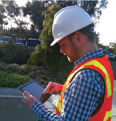
SWIFTview integrates with Esri workforce, meaning you can instruct an employee to go into the field and check the problem.
The employee can then report back, through the application on his/her cellphone, and the results are updated in realtime, straight back into SWIFTview.
Who can benefit from SWIFTview?
Linear
Servitudes
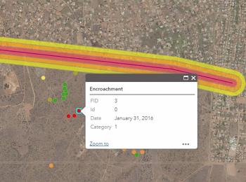
Railways, power lines, pipelines, and any other linear infrastructure that has servitudes require real time monitoring for encroachment. Our technology enables users to monitor these areas, but goes one step further by automatically detecting where encroachment occurs and alerting the user via e-mail or push notification.
Land
Parcels
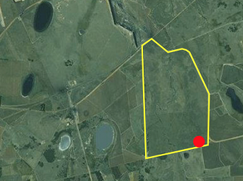
Spatial planners in all spheres can benefit form real time imagery. The information derived from the imagery can be used for monitoring sites, as well as to inform planning decisions by tracking movements of people and development.
Forestry and Agriculture
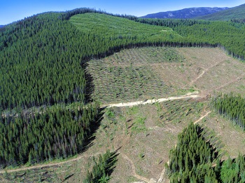
Forestry and Agriculture require monitoring over large areas, with timeous captures and reports. With daily imagery, there is no need to decide when to capture, stands and crops are captured very day. The insight gained is unparalleled, while real time monitoring for pests, disease, illegal clearing and fires is now a reality.
Water Health Monitoring

Algae blooms and water hyacinth outbreaks happen in days when conditions are right. Daily monitoring means a pro active approach is now possible. In addition, by tracking the source, direction and speed of the bloom/outbreak, insight is gained into the problem, not just the consequences. Within SWIFTview, access to all historic imagery over your site is included.
Linear
Servitudes
Land
Parcels
Forestry and Agriculture
Water Health Monitoring
Railways, power lines, pipelines, and any other linear infrastructure that has servitudes require real time monitoring for encroachment. Our technology enables users to monitor these areas, but goes one step further by automatically detecting where encroachment occurs and alerting the user via e-mail or push notification.
Spatial planners in all spheres can benefit form real time imagery. The information derived from the imagery can be used for monitoring sites, as well as to inform planning decisions by tracking movements of people and development.
Forestry and Agriculture require monitoring over large areas, with timeous captures and reports. With daily imagery, there is no need to decide when to capture, stands and crops are captured very day. The insight gained is unparalleled, while real time monitoring for pests, disease, illegal clearing and fires is now a reality.
Algae blooms and water hyacinth outbreaks happen in days when conditions are right. Daily monitoring means a pro active approach is now possible. In addition, by tracking the source, direction and speed of the bloom/outbreak, insight is gained into the problem, not just the consequences. Within SWIFTview, access to all historic imagery over your site is included.
How it works
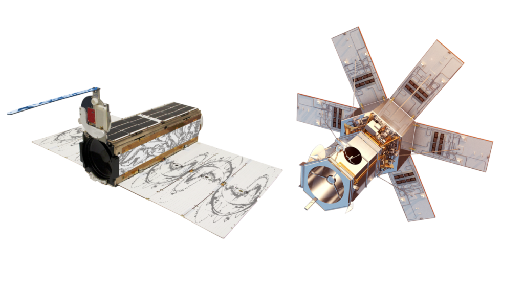
Satellites from 2 highly advanced constellations collect data, daily.
Subscription services for the data these satellites collect keep the cost per image extremely low.

Ground Stations receive and store the data
The imagery is stored on servers with 99.95% uptime, ensuring no time lost without access to your data.

Propriety algorithms are performed on the data, whilst on the servers
This reduces delays due to downloading the data, whilst harnessing the power of cloud computing.
All results are manually checked by Swift Geospatial staff.
The results are served to the SWIFTview online platform, along with the up to the minute satellite imagery.
This online map service is easy to use, constantly updated and available anywhere a web browser and internet connection are available.
The SWIFTview portal interface
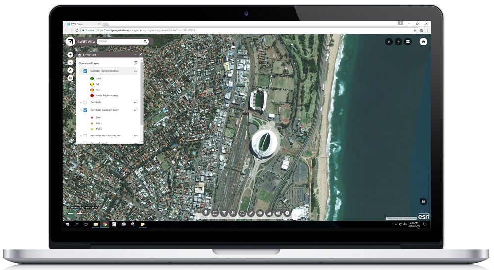
The SWIFTview online portal has a clear and easy to understand interface. Common tools like a layer manager and search tool are easy to find and use, while widgets for more specific uses, such as measurement, filters and printing, are found at the bottom of the page.
All of these tools are customizable.
There is no need for any specific software, training or personnel to get all the benefits of SWIFTview, just a basic understanding of the product, a web browser and an internet connection.
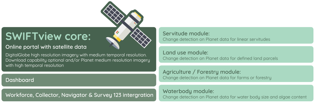
The Structure of SWIFTview