Introducing A New Era of Earth Monitoring Solutions at Swift Geospatial
Swift Geospatial is entering a new era of GIS monitoring solutions with the launch of SWIFTFarm, SWIFTForest, SWIFTDetect, and SWIFTMine. Designed to transform satellite imagery, remote sensing, and geospatial intelligence into actionable business insights, these industry-specific monitoring platforms help organisations gain greater visibility over their operations, identify risks earlier, and make more informed decisions. Discover how modern earth observation technologies, AI-driven analytics, and continuous monitoring are reshaping the future of mining, forestry, agriculture, environmental management, and infrastructure oversight.
Categories:
Date Posted:
June 8, 2026
Introducing A New Era of Earth Monitoring Solutions at Swift Geospatial
For years, GIS and satellite imagery have quietly powered some of the most important decisions across mining, agriculture, forestry, environmental management, and infrastructure development. Yet despite the sophistication of the technology, access to meaningful monitoring systems has often remained fragmented, technical, or disconnected from the people making strategic business decisions.
That is beginning to change.
With the launch of the new Swift Geospatial website and suite of industry specific monitoring solutions, we are introducing a clearer, more focused direction for the business, one centred around practical earth monitoring solutions designed to support real operational decision making. Not just maps. Not just imagery. Actionable visibility.
The new website showcases four dedicated monitoring platforms developed to solve industry-specific challenges through GIS, remote sensing, and satellite imagery analysis:
- SWIFTForest – Commercial and Natural Forest Visibility Starts Here.
- SWIFTFarm – What starts as a small patch of stress today can become tomorrow’s lost yield.
- SWIFTDetect – If you can see it, you can act on it.
- SWIFTMine – You can’t manage mining risk if you can’t see what’s changing.
Each platform has been built around a simple idea. Better visibility leads to better decisions.
And honestly, that sounds obvious until you consider how many industries still operate with delayed reporting, disconnected field information, or incomplete oversight of massive operational areas. Satellite monitoring changes that equation dramatically.

Monitoring Has Shifted From “Nice To Have” To Operational Necessity
There was a time when satellite monitoring was treated as a specialised technical service reserved for large government departments or research institutions. That era feels distant now.
Modern businesses are expected to move quickly. Executives need accurate information faster than ever before. Investors expect accountability. Environmental pressures continue to increase. Compliance requirements evolve constantly. Meanwhile, operational footprints keep growing.
The challenge is not necessarily the absence of data. Most organisations already have data everywhere. The challenge is visibility.
Can decision-makers actually see what is changing across their operations?
Can they identify risks early enough to act?
Can they monitor trends consistently over time instead of relying on isolated inspections or outdated reporting cycles?
That’s where GIS and earth observation monitoring become incredibly valuable. They provide continuity. A living visual record of change across landscapes, operations, infrastructure, and environmental systems.
The new Swift Geospatial product suite has been designed specifically around that principle.

A Website Built Around Monitoring Intelligence
The launch of the new Swift Geospatial website represents more than a visual redesign. It signals a strategic evolution in how the company presents GIS monitoring solutions to the market.
Rather than positioning GIS as a purely technical discipline, the new structure focuses on operational outcomes and executive visibility. The platform pages have been designed to explain how satellite imagery and GIS monitoring support faster, more informed business decisions across multiple industries.
Each solution now has its own dedicated identity, industry focus, and monitoring purpose.
It creates a clearer experience for clients exploring earth observation solutions while also strengthening how businesses understand the role geospatial intelligence can play inside their operations.
You know what’s interesting? Many companies already collect massive amounts of operational information through field teams, reports, drones, inspections, and compliance systems. But without a central monitoring layer, patterns become difficult to identify. Risks remain hidden longer than they should.
Satellite monitoring changes that dynamic because it introduces consistency. The same locations can be monitored repeatedly over time, creating measurable visual records that support both operational and strategic decisions.
That philosophy now sits at the centre of Swift Geospatial’s direction moving forward.

Does it involve AI?
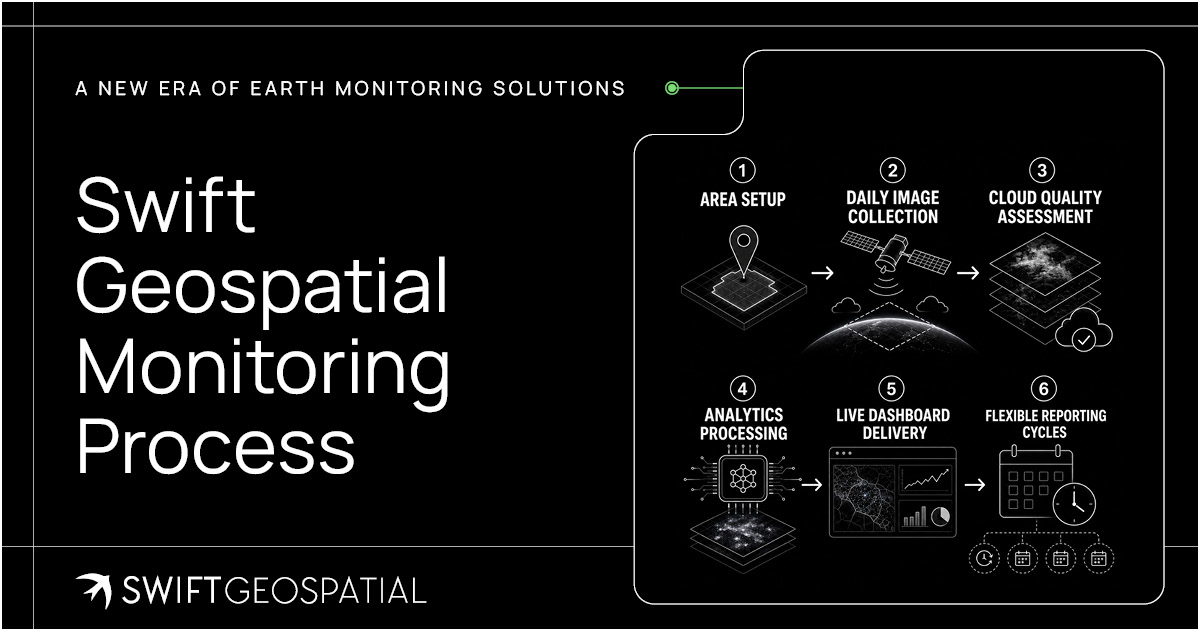
The use of AI is finding it’s way into every facet of our lives, and earth monitoring is no exception. Modern earth monitoring solutions are no longer driven by satellite imagery alone. Advances in AI, cloud computing, automation, and machine learning are rapidly changing how GIS data is processed, interpreted, and delivered to businesses. Swift Geospatial is actively embracing these technological advancements to create monitoring solutions that are faster, smarter, and better suited to real operational needs.
Rather than overwhelming companies with raw datasets, the focus is on building systems that surface meaningful insights, identify patterns earlier, automate repetitive analysis, and support quicker decision making across large operational environments. As industries continue generating more spatial data than ever before, the ability to intelligently process that information becomes just as important as collecting it in the first place.
SWIFTForest And The Growing Need For Forestry Visibility
Forestry operations cover enormous areas. Sometimes remote. Often difficult to inspect consistently. Constantly changing.
That creates obvious monitoring challenges.
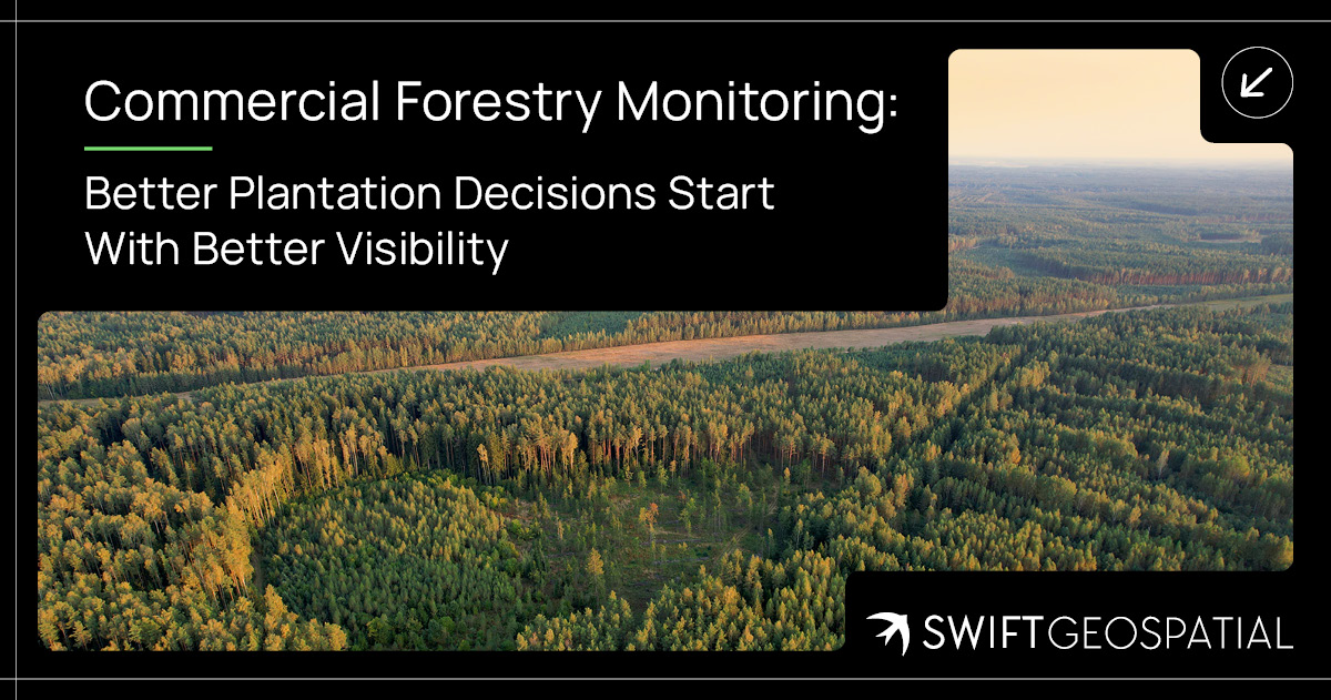
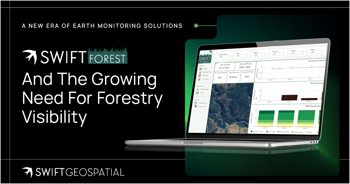
SWIFTForest has been developed to assist forestry operations through ongoing earth observation monitoring, helping organisations track plantation health, vegetation changes, harvesting activity, encroachment, and environmental trends across large landscapes.
Forestry management has become significantly more complex over the last decade. Sustainability reporting expectations have increased. Fire risks remain constant. Illegal activity and encroachment continue to affect plantations globally. Environmental accountability now carries financial implications as well as reputational ones.
Satellite monitoring introduces a broader perspective that ground operations alone simply cannot maintain consistently.
And here’s the thing. Monitoring forests effectively is not just about seeing trees. It is about understanding patterns over time.
How is vegetation density changing?
Are there signs of degradation?
Are harvesting activities progressing according to planning schedules?
Are environmental buffers being maintained?
SWIFTForest creates a structured way to answer those questions visually and repeatedly through GIS analysis and satellite imagery interpretation.
For executives overseeing large forestry assets, that visibility becomes increasingly important as operations expand and reporting pressures intensify.

SWIFTFarm, Seeing Agricultural Change Before It Becomes A Problem
Agriculture has always depended on timing. Timing rainfall. Timing harvesting. Timing interventions. Timing resource allocation.
The problem is that traditional farm monitoring often reacts to issues after they are already visible from the ground.
SWIFTFarm introduces continuous agricultural monitoring through satellite imagery and GIS analysis, allowing farming operations to monitor crop health, field stress, vegetation trends, harvesting activity, and broader land management changes through a custom online platform.
Instead of relying solely on isolated field inspections, decision-makers gain access to recurring visual intelligence covering entire farming operations.
That matters enormously for large agricultural businesses.
A single delayed response to crop stress or irrigation failure can ripple across production cycles and operational costs. With modern remote sensing imagery, those early indicators often become visible long before they are obvious from the ground.
The platform is designed to support:
- Crop health monitoring
- Vegetation analysis
- Harvest tracking
- Land use observation
- Operational planning
- Historical change analysis
And importantly, the information becomes accessible to both operational teams and executive management.
Because that’s the real shift happening across agriculture right now. GIS is no longer just for specialists sitting behind technical software. It is becoming a decision support system for business leadership.
SWIFTDetect, Monitoring Change Where It Matters Most
Sometimes the biggest operational risk is not what is happening inside a site. It is what is happening around it.
Encroachment monitoring has become one of the most critical applications of modern satellite monitoring systems, particularly across municipal land, servitudes, infrastructure corridors, mining rights areas, and environmentally protected zones.
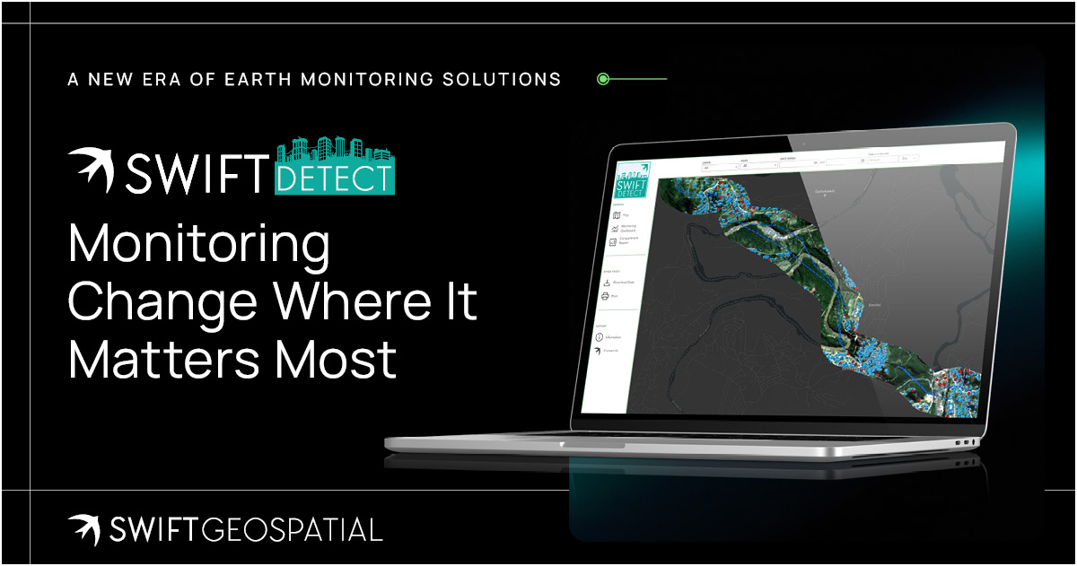
SWIFTDetect has been developed specifically to monitor surface change and identify unauthorised activity or encroachment through recurring satellite analysis.
The platform allows organisations to monitor areas of interest continuously, providing visibility into developing risks before they escalate into larger operational or legal complications.
That capability is becoming increasingly valuable across both public and private sectors.
- Infrastructure operators need visibility over servitudes.
- Municipalities need monitoring over land occupation.
- Developers require oversight of project boundaries.
- Mining companies need awareness of surrounding land activity.
- Environmental teams need records of change over time.
Traditionally, much of this relied on inspections, reporting delays, or reactive investigations. Satellite monitoring introduces a far more consistent approach. And consistency matters. Especially for executive leadership managing operational exposure across multiple sites or regions.
SWIFTDetect essentially creates an ongoing layer of awareness across monitored environments. Quietly observing change. Quietly identifying movement. Quietly supporting faster response times.
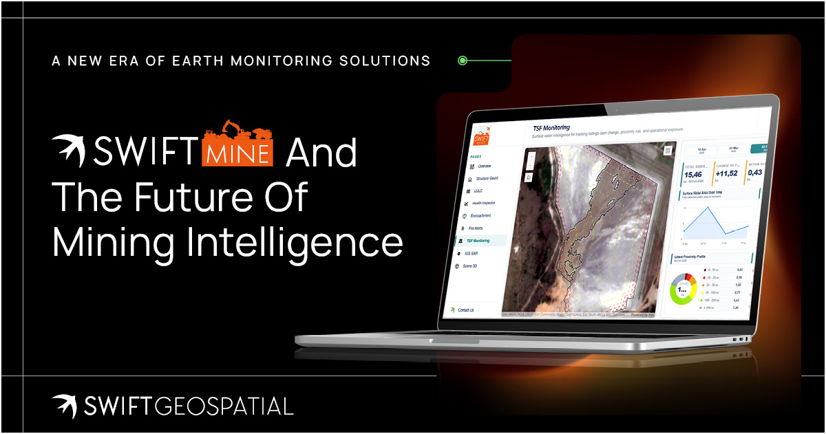
SWIFTMine And The Future Of Mining Intelligence
Mining operations generate enormous spatial complexity.
Tailings facilities, rehabilitation zones, environmental compliance areas, active pits, haul roads, prospecting regions, water systems, vegetation offsets, surrounding communities, infrastructure expansion, the list goes on.
Trying to monitor all of that manually becomes increasingly difficult as operations grow.
SWIFTMine has been developed to provide mining companies with ongoing monitoring capabilities through GIS and satellite imagery, supporting visibility across operational and environmental landscapes.
The platform assists with:
- Tailings storage facility monitoring
- Environmental monitoring
- Rehabilitation tracking
- Surface change analysis
- Encroachment monitoring
- Water monitoring
- Exploration visibility
- Compliance support
Mining executives today operate inside a very different environment compared to even ten years ago. ESG reporting expectations are higher. Investors expect transparency. Environmental accountability carries real financial implications. Operational disruptions move faster through public scrutiny than ever before.
Because of that, access to timely geospatial intelligence is becoming increasingly valuable at executive level, not only at technical level.
SWIFTMine has been positioned specifically around that operational reality.
It is not simply about collecting imagery. It is about translating landscape change into decision-making visibility.

Why This Matters For C-Suite Decision Making
One of the most important shifts happening inside the GIS industry right now is who uses the information.
Historically, satellite imagery and GIS analysis were highly technical environments. Specialists produced reports. Analysts interpreted datasets. Executives often only saw the final summaries.
That model is evolving quickly.
Modern monitoring platforms increasingly place visual intelligence directly into the hands of operational leadership, executive management, and strategic decision-makers.
Why?
Because spatial visibility influences business decisions everywhere.
- Risk management.
- Environmental accountability.
- Operational planning.
- Asset protection.
- Infrastructure oversight.
- Long-term forecasting.
- Capital allocation.
- Compliance management.
When executives can visually monitor operational environments consistently over time, decision-making becomes more informed and often significantly faster.
That is really the underlying direction behind the new Swift Geospatial platform ecosystem, built not just for GIS professionals, but earth monitoring solutions that support business leadership itself through easy to analyse and dashboard presented information.
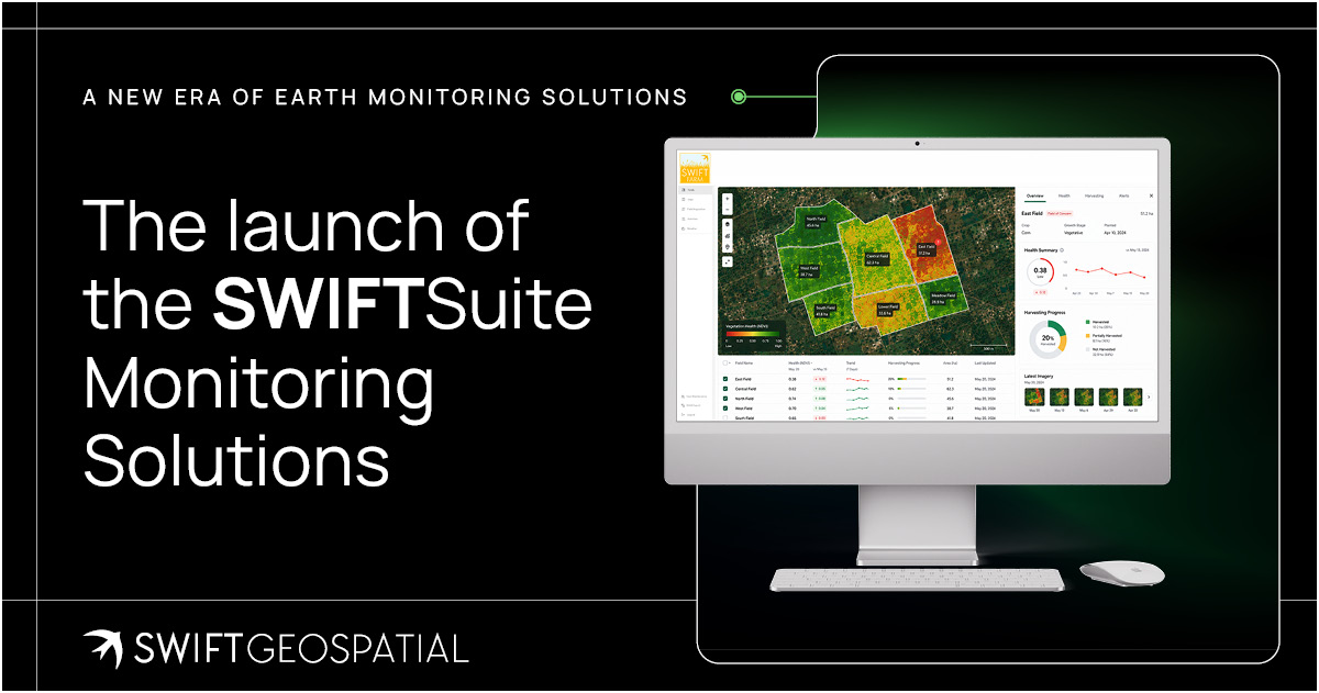
The launch of the SWIFTSuite Monitoring Solutions
The launch of SWIFTFarm, SWIFTForest, SWIFTDetect, and SWIFTMine marks an important step in the evolution of Swift Geospatial.
The business is moving further into structured monitoring solutions designed around specific industries, operational challenges, and long-term decision support.
Over the coming months, each platform will receive dedicated exploration through individual articles, industry insights, and deeper technical discussions. The goal is not simply to showcase technology for the sake of technology. It is to explain how GIS and satellite monitoring genuinely assist organisations in seeing operational realities more clearly.
Because ultimately, visibility changes how decisions are made.
And in industries shaped by land, infrastructure, resources, environmental pressure, and operational scale, the ability to monitor change continuously is no longer a future concept.
It is becoming essential. Contact us today to learn more about our earth monitoring and GIS solutions with our sales team.