Forest Conservation Technology: How SWIFTForest Makes Environmental Change Visible
Forest conservation depends on the ability to see and understand environmental change before it becomes irreversible. SWIFTForest combines satellite imagery, recurring disturbance alerts and specialist GIS analysis to help organisations monitor deforestation, forest degradation, wildfire damage, encroachment and other pressures affecting natural forests. Through interactive mapping, verification tools and structured reporting, the platform turns complex geospatial data into practical intelligence that supports conservation planning, field investigations, environmental compliance and more informed forest management.
Categories:
Date Posted:
August 13, 2026
Natural Forest Monitoring: Protecting Forests Starts With Seeing What Is Changing
Natural forests are living systems, not static green patches on a map. They breathe through seasons, respond to rainfall, carry biodiversity, store carbon, protect water systems, and support communities in ways that are often difficult to measure from the ground alone. Yet, for all their value, many forests remain surprisingly hard to monitor.
A field team may know one section well. A ranger may spot a problem along a regular route. A conservation manager may receive a report from a community member, a partner organisation, or a government department. But forests are vast, complicated, and often remote. By the time illegal clearing, canopy loss, fire damage, encroachment, or degradation is visible through conventional reporting, the damage may already be well underway.
That is the challenge SWIFTForest’s Natural Forest Monitoring platform is built to address.
Natural Forest Monitoring gives organisations a clearer, faster, and more reliable way to understand what is happening across forest landscapes. By combining satellite imagery, GIS analysis, disturbance alerts, and an interactive monitoring dashboard, Swift Geospatial helps users detect forest change, verify areas of concern, and make better environmental decisions with confidence.
In simple terms, it helps answer the question every forest manager, conservation officer, sustainability lead, and land custodian eventually has to ask: what changed, where did it happen, and what should we do about it?

You Can’t Protect What You Can’t Measure
The phrase may sound blunt, but it cuts straight to the heart of natural forest management. Protecting forests requires visibility. Not occasional visibility. Not a once-a-year survey tucked away in a PDF. Ongoing visibility.
Natural forests face pressure from several directions at once. Illegal logging, agricultural expansion, informal settlement growth, mining activity, infrastructure development, wildfire damage, biodiversity loss, and slow environmental degradation can all affect forest condition. Some of these changes happen suddenly. Others creep in gradually, almost politely, until the pattern becomes impossible to ignore.
That is why monitoring matters.
SWIFTForest transforms satellite imagery into actionable environmental intelligence. Instead of relying only on delayed field surveys or fragmented reporting, users can monitor forest landscapes remotely and review change through a single integrated platform. This gives teams a shared view of forest loss, disturbance, degradation, and areas that may need further investigation.
It does not remove the need for fieldwork. Far from it. It makes fieldwork sharper. Instead of sending people out to search blindly across difficult terrain, teams can focus attention on priority areas identified through spatial data.
That is a better use of time, budget, and human energy.
What Is Natural Forest Monitoring?
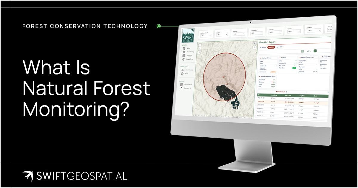
Natural Forest Monitoring is the use of satellite imagery, remote sensing, GIS analysis, and recurring change detection to monitor the health, condition, and stability of natural forest ecosystems. Within SWIFTForest, this process is designed to help organisations identify and verify forest disturbances, track degradation, map environmental risk, and understand landscape trends over time.
The platform makes use of third-party forestry disturbance alerts, combined with optical satellite imagery for verification. Analyses are updated weekly, which gives users a near real-time view of potential deforestation disturbances, degradation events, and areas of concern across predefined areas of interest.
That weekly rhythm is important. Forest risk does not wait for quarterly meetings.
By monitoring forests at regular intervals, SWIFTForest builds a living record of environmental change. This record can support conservation planning, biodiversity protection, carbon-related reporting, environmental compliance, EUDR risk assessment, and long-term landscape management.
In other words, it turns forests from distant assets into measurable, manageable ecosystems.

From Disturbance Alerts to Better Decisions
A disturbance alert is not the final answer. It is the start of a better question.
When a potential forest disturbance is detected, decision-makers need to know whether the change is expected, authorised, harmful, urgent, or uncertain. A red mark on a map may indicate illegal logging, but it could also relate to fire damage, land clearing, storm impact, seasonal change, or a known activity within the area. Context matters.
SWIFTForest helps by fusing disturbance alerts with satellite imagery and in-house verification. This layered approach allows users to review the alert, compare it against recent imagery, and assess the risk more clearly. The platform then presents insights through maps, monitoring tools, heatmaps, and visual layers that make it easier to interpret what is happening.
This is where GIS becomes more than mapping. It becomes a decision engine. Swift Geospatial’s in-house GIS specialists bring the imagery, disturbance alerts, historical records, terrain data, and project boundaries together within a structured spatial analysis. Their expertise is essential because a satellite image on its own is only a picture of the landscape at a particular moment. GIS analysis gives that picture location, context, comparison, and meaning, helping teams distinguish isolated changes from wider patterns and turn raw observations into evidence that can support practical action.
For government departments, it can support enforcement and environmental oversight. For NGOs and NPOs, it can help monitor forests across regions without constant physical access. For conservation teams, it can guide interventions. For corporate sustainability teams, it can support transparent reporting. For landowners, it can provide an early warning system for activities that may otherwise remain hidden.
The point is not to create more data for the sake of data. Nobody needs another digital cupboard full of dusty reports. The point is to create useful intelligence that leads to action.


A Practical Tool for Governments, NGOs, Conservation Teams, and Landowners
Natural forest protection involves many different stakeholders. The people responsible for forests are not always sitting in the same office, working from the same dataset, or dealing with the same priorities.
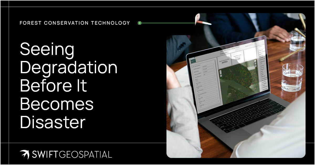
Government teams may need to monitor compliance, encroachment, protected areas, and environmental law enforcement. NGOs and NPOs may need to monitor remote forests across large regions with limited field resources. Conservation teams may need biodiversity and habitat insights. Companies may need to prove responsible sourcing or understand EUDR-related exposure. Landowners may need a reliable way to monitor unauthorised activity or environmental risk.
SWIFTForest gives these stakeholders a shared platform for viewing change.
The Map page allows users to visualise RGB imagery and disturbance alerts, with features such as time sliders, filters, and dual map modes. Layers can be switched on and off, including RGB imagery, disturbance alerts, and wildfire tracking. The Monitoring page brings imagery and analytical insights together, allowing users to select individual areas, grouped areas, or all monitored areas to assess degradation, deforestation, and disturbance alerts through the latest spatial data.
The reporting tools add another layer of value. Users can generate reports based on selected areas or broader monitoring requirements, with customisable layouts that support communication, recordkeeping, and decision-making.
And honestly, this is where many environmental systems fail or succeed. It is not enough to detect the problem. The platform also has to help people explain it.

A Platform Built for Practical Forestry Decisions
A worthwhile forestry monitoring platform cannot be a beautiful map that nobody is using. It has to built to fit into the way forestry teams, environmental managers, executives, GIS specialists, and field crews actually work.
SWIFTForest is designed around practical forestry monitoring needs. Dedicated users can view areas of interest, monitor specific sites or grouped areas, review analytical insights, and use the latest spatial data to understand conditions across their forestry assets or conservation landscapes.
For GIS specialists, the value is in the quality and structure of the spatial workflows. For engineers and operational managers, it is in the ability to identify risk, coordinate teams, and support planning. For business owners and executives, it is in better oversight and stronger evidence for decisions. For accountants, insurers, and financial managers, it can support asset visibility, risk documentation, and more reliable reporting.
That mix matters because forestry is not managed by one department alone. It sits at the intersection of operations, finance, sustainability, compliance, land management, and environmental responsibility.
SWIFTForest gives those teams a shared spatial picture.

EUDR Risk, Traceability, and Environmental Accountability
Environmental accountability is no longer a soft conversation tucked into the back of a sustainability report. It is becoming a core business and compliance issue.
The European Union Deforestation Regulation, often referred to as EUDR, has placed increased attention on deforestation-related risk in supply chains. Organisations connected to forest-linked commodities need stronger systems for verification, risk assessment, reporting, and traceability. Even outside Europe, the pressure for defensible environmental data is growing.
SWIFTForest supports EUDR risk assessment, verification, and reporting by helping clients understand potential deforestation-related risks across their areas of interest. The platform provides spatial evidence that can support supply chain transparency, land-use history review, and environmental due diligence.
This is not only about avoiding penalties or ticking boxes. It is about trust.
Buyers, regulators, investors, communities, and partners increasingly want proof that environmental claims are grounded in real data. Satellite-based monitoring creates a more traceable record of what has happened across a landscape, when it happened, and where attention may be needed.
That record can become a valuable part of responsible land management.

Heatmaps That Show Where Concern Is Growing
Some forest risks are immediate. Others are cumulative.
A single disturbance may not tell the whole story, but a pattern of repeated alerts across a region can reveal where pressure is increasing. This is where heatmap analysis becomes useful. SWIFTForest uses tailored heatmap analysis to identify areas of elevated concern and provide a clearer visual risk assessment.
For decision-makers, this can be incredibly helpful.
Instead of working through scattered alerts one by one, users can see where risk is clustering. They can identify priority zones, compare concern levels, plan inspections, guide conservation work, allocate resources, and communicate risk in a way that is easier for different teams to understand.
A heatmap will not replace expert interpretation, but it can focus attention quickly. It says, in effect, “Start here.”
For large natural forest areas, that can save time and help teams respond before small problems become landscape-level trouble.

Remote Monitoring Reduces Blind Spots
Many natural forests are difficult to access. Some are remote. Some are rugged. Some are affected by poor road infrastructure, seasonal weather, security concerns, or cost constraints. Even where access is possible, regular ground surveys can be expensive and time-consuming.
Remote monitoring changes that equation.
With SWIFTForest, organisations can monitor large areas from a central platform while still using field teams where they add the most value. The system does not ask fieldwork to carry the whole burden. It gives field teams direction, context, and priority areas to investigate.
This is particularly useful for conservation projects and environmental programmes that cover large or scattered areas. When budgets are tight, teams need to know where their attention will matter most. Remote forest monitoring helps them move from broad uncertainty to targeted response.
It is a bit like turning on the lights in a very large room. You still need to walk through it, but at least you can see where the furniture is.

Built for Weekly Monitoring and Real-World Use
A monitoring platform should not feel like a locked vault that only technical specialists can open. SWIFTForest has been designed to be live, interactive, and easy to use, while still supporting the advanced spatial workflows needed by GIS professionals and environmental analysts.
The platform includes simple login access, intuitive colours, legends, labelling, fast load times, and REST API compatibility for integration into existing systems where needed. This matters because forestry intelligence should not live in isolation. It often needs to connect with internal reporting systems, compliance processes, operational planning, environmental management workflows, or partner dashboards.
The workflow is clear. Users register on SWIFTForest and upload their areas of interest. Monitoring frequency is determined. Disturbance alerts are fused with satellite imagery, such as Sentinel-2 or PlanetScope imagery, and the system runs weekly analysis on the predefined areas. The dashboard then updates with the latest imagery and analytics.
It is structured, repeatable, and practical.

Satellite Imagery Selected for the Question at Hand
spatial resolution, revisit frequency, and spectral detail for the question being asked. SWIFTForest can draw on PlanetScope’s daily, 3-metre, 8-band multispectral imagery for frequent monitoring across large forest areas, giving analysts a consistent view of vegetation and landscape change. Where a disturbance needs closer visual inspection, Planet SkySat offers ad hoc archived imagery and new tasking at 30-centimetre or 50-centimetre resolution across four bands.
Vantor’s Legion Series and WorldView imagery provides further high-resolution options, including 15-centimetre HD, 30-centimetre, and 50-centimetre products with configurations ranging from four to sixteen bands, as well as stereo tasking where suitable. Vantor digital terrain models and digital surface models, available at 50 centimetres, 1 metre, 2 metres, and 4 metres, can add elevation and surface context to the analysis.
Rather than treating the highest resolution as the automatic choice, Swift Geospatial’s GIS specialists assess the monitoring area, required frequency, level of detail, analytical goal, and budget to select an appropriate dataset or combination of datasets. This balance between frequent coverage and close-detail verification gives users imagery that is technically fit for purpose and analysis they can use with confidence.
That repeatability is where the platform earns its place. Natural forest monitoring is not a once-off project. It is an ongoing responsibility.

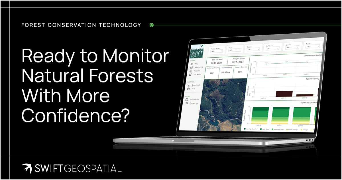
Ready to Monitor Natural Forests With More Confidence?
Natural Forest Monitoring from Swift Geospatial helps organisations detect deforestation, monitor degradation, verify disturbance alerts, assess EUDR-related risk, and track landscape health through a secure, interactive platform.
Whether the goal is conservation, compliance, biodiversity protection, carbon-related reporting, wildfire review, or long-term environmental stewardship, SWIFTForest gives teams the visibility they need to act sooner and report with greater confidence.
To learn more about Natural Forest Monitoring or request a tailored quotation for your areas of interest, contact Swift Geospatial and book a consultation.
Article FAQ’s
SWIFTForest is designed for government departments, NGOs, NPOs, conservation organisations, landowners, sustainability teams and businesses responsible for natural forest areas. It can support biodiversity protection, conservation planning, EUDR risk assessment, carbon reporting, environmental compliance, wildfire analysis and long-term forest management.
SWIFTForest can help identify and monitor deforestation, forest degradation, canopy loss, wildfire damage, burn scars, encroachment and other forms of landscape disturbance. GIS analysis helps place each detected change within its wider environmental and geographical context. Potential disturbances can then be verified using recent satellite imagery or targeted field inspections.
Satellite imagery allows organisations to observe natural forests without relying only on physical inspections. SWIFTForest can use frequent PlanetScope imagery to monitor broad landscape change and higher-resolution Planet SkySat or Vantor imagery to examine specific disturbances in greater detail. Swift Geospatial’s GIS specialists select imagery according to the monitoring area, required detail, frequency and project objectives.
SWIFTForest supports natural forest monitoring by combining recurring satellite imagery with disturbance alerts and GIS expertise. The platform monitors predefined areas of interest and provides updated maps, analytical layers, heatmaps and reports. This helps conservation teams understand what changed, where it happened and which areas may require investigation or intervention.
Forest conservation technology includes satellite imagery, GIS analysis, remote sensing, disturbance alerts and digital reporting tools used to protect natural forests. SWIFTForest brings these technologies together within an interactive platform, helping organisations detect deforestation, degradation, wildfire damage, encroachment and other environmental changes across large forest landscapes.